Best eSIM Coverage for Rural Japan: Alps, Hokkaido, Islands
Japan's networks reach 99.9% of people but only about 60% of the land. How to pick an eSIM that holds up in the Alps, Hokkaido and the islands.
On this page
- What does Japan's "99.9%" coverage figure actually measure?
- Which Japanese network has the best rural coverage?
- Which networks do travel eSIMs for Japan actually use?
- Where does coverage genuinely thin out in Japan?
- How do you check coverage for your exact route before you buy?
- Route-by-route: what to check before you go
- Does satellite messaging fill the gaps?
- Offline prep checklist for rural Japan
- Frequently asked questions
- Sources
Disclosure Some links on this page are affiliate links. If you buy through them we may earn a small commission at no extra cost to you. It never changes what we recommend.
Short answer: for rural Japan, choose a travel eSIM whose published operator list includes NTT Docomo and/or KDDI (au), because those two networks carry the most build-out in mountain and island areas. Japan’s headline coverage numbers describe people, not terrain — KDDI states that au’s population coverage is above 99.9% while its land-area coverage is only about 60%. That gap is exactly where the Japanese Alps, interior Hokkaido and the smaller islands sit, so the network your eSIM roams onto matters far more off the Shinkansen corridor than it does in Tokyo.
What does Japan’s “99.9%” coverage figure actually measure?
Japanese carriers quote population coverage. That measures the share of people who live inside a covered area, and in a country where most people live in a handful of dense corridors, it climbs close to 100% long before the mountains are covered.
KDDI put the two numbers side by side when it launched its satellite service: au’s population coverage is “more than 99.9%,” while its “area coverage rate is approximately 60% due to Japan’s unique topography.” The remaining ~40% of the landmass is mountains, forest and open water — which is a fair description of most of what makes rural Japan worth visiting.
5G is still in its build-out phase. The Ministry of Internal Affairs and Communications (MIC) reported a nationwide 5G population coverage rate of 98.4% as at the end of FY2024 (31 March 2025), but with a per-prefecture spread from 88.4% to 99.9%. In practice, plan for 4G/LTE as your baseline outside cities and treat 5G as a bonus.
Which Japanese network has the best rural coverage?
There is no single published, apples-to-apples ranking of rural coverage across the four Japanese carriers, so the most reliable approach is to compare the carriers’ own maps and look at which carrier has built infrastructure specifically for the terrain on your route.
On that second measure, NTT Docomo is the one that publishes the most mountain-specific work. Its area site has a dedicated section explaining four techniques it uses on climbing routes: antennas aimed at summits, small base stations mounted on mountain-lodge roofs, booster stations that relay signal up from lower elevations, and seasonal base stations installed and removed around the climbing season. Docomo also notes that methods vary by mountain and that not all four are used everywhere.
Docomo goes further and publishes a lookup for “climbing routes where mobile phones can be used,” searchable by region with per-mountain maps. The page carries an honest caveat: the maps show approximately usable spots, and reception may still be difficult depending on conditions.
KDDI (au) publishes prefecture-level maps for 5G and 4G LTE, including a separate map for its 4G LTE 1.7GHz+2.0GHz layer, plus au Wi-Fi spot locations and — usefully — the area where it provides roaming to Rakuten Mobile. SoftBank publishes a service area map for its 5G, 4G LTE and 4G layers from its network section.
Rakuten Mobile is unusually transparent about how its rural coverage is delivered. Its own coverage page distinguishes between Rakuten’s own 4G/5G network and areas served through au/KDDI partner lines, and it points you to KDDI’s separate roaming area map so you can see exactly where that applies. In a remote valley, that means checking both maps gives you a clear picture of what to expect.
Which networks do travel eSIMs for Japan actually use?
Travel eSIMs do not build networks; they resell roaming onto Japanese carriers. So the only question that matters for rural performance is which carriers a given plan lists. Providers publish this on their plan pages, and the list can be updated at any time — so the provider’s own page is always the best place to confirm before you buy, alongside an article like this one.
Here is what two widely used providers list on their own pages, checked in August 2026:
| Provider / plan | Operators listed on the provider’s page | Price (as of August 2026) | What this implies for rural areas |
|---|---|---|---|
| Ubigi — Japan 10GB / 30 days | KDDI (4G and 5G) and NTT Docomo (4G); no 3G | US$16.50 (as of August 2026) | Lists both of the carriers with the heaviest remote build-out, which suits itineraries weighted towards mountains and islands |
| Ubigi — Japan unlimited / 15 days | KDDI and NTT Docomo | US$39.00 as of August 2026 (30GB at full speed, then reduced to 2 Mbps) | Same operator set; the speed step-down is a throughput limit, not a coverage limit |
| Airalo “Moshi Moshi” — 10 days unlimited | SoftBank, plus one further partner network | US$34.50 as of August 2026 (page notes reduced speed) | SoftBank publishes its own area map, which is a good one to check against the rural stops on your route |
| Airalo “Moshi Moshi” — other unlimited tiers | As above | As of August 2026: US$11.50 / 3 days, US$17.00 / 5 days, US$27.00 / 7 days, US$48.00 / 15 days, US$69.00 / 30 days | Choose by trip length; the operator list is the same across tiers |
The practical takeaway is about fit: if your itinerary is mostly rural, a plan that names Docomo and KDDI puts more of the country’s remote-area infrastructure within reach, while a single-carrier plan is a comfortable fit for trips that stay closer to the cities and main corridors. Signal in any specific valley depends on terrain, so checking the carrier maps for your own route is the step that pays off most.
Where does coverage genuinely thin out in Japan?
Four kinds of terrain account for most of the dead zones travellers actually hit.

Interior Hokkaido. The population is concentrated around Sapporo, Asahikawa and the coastal cities; the middle of the island is national park, forest and farmland with long unserved stretches between towns. Long drives are where you notice it, because you lose signal for tens of kilometres rather than a few minutes.
Note that MIC’s prefecture spread for 5G ran as low as 88.4% at the end of FY2024 — the report does not name which prefecture sat at the bottom, so don’t assume it was Hokkaido, but it does show how wide the gap between the best and worst prefecture is.
Japanese Alps valleys and trails. This is the terrain Docomo’s mountain program exists for. The key thing to internalise is that some of that coverage is seasonal: Docomo describes base stations installed and removed around the climbing season, so a trail that has signal in August may not in February.
Seto Inland Sea and Okinawan islands. Coverage on the populated islands is generally built out because people live there, but the water between islands, the smaller uninhabited islands and ferry crossings are a different matter. KDDI’s map set includes a maritime 4G LTE layer, which tells you that over-water coverage is treated as a distinct thing rather than assumed.
Rural rail and tunnels. Long tunnel sections and steep-sided valleys interrupt signal on local lines even where the towns at each end are covered. Docomo’s area site lists subway and tunnel coverage as its own category alongside mountains, which again signals that these are separately engineered rather than automatic.
How do you check coverage for your exact route before you buy?
All four carriers publish free, public maps. You do not need an account, and you do not need to read Japanese fluently — the maps are visual, and prefecture names are searchable.
| Carrier | Official map | What you can check |
|---|---|---|
| NTT Docomo | docomo.ne.jp/area/ | Prefecture-level 5G, LTE and 5G SA; separate sections for mountains, subways and public Wi-Fi; a banner for planned quality-improvement areas in FY2026 |
| NTT Docomo (mountains) | docomo.ne.jp/area/service_area/mountains/ | Region-by-region lookup of climbing routes with per-mountain maps |
| KDDI (au) | au.com/mobile/area/ | Maps for all 47 prefectures, 5G and 4G LTE layers including the 1.7GHz+2.0GHz map, au Wi-Fi spots, and the Rakuten Mobile roaming area |
| SoftBank | softbank.jp/mobile/network/area-map/ | SoftBank 5G, 4G LTE and 4G service areas |
| Rakuten Mobile | network.mobile.rakuten.co.jp/area/ | Own-network vs au partner roaming area, a full-screen zoomable map, a pinpoint simulation for a specific address, and per-prefecture pages |
A workable method: list the three or four places on your itinerary that are furthest from a city, then check each of them on the map for whichever carrier your eSIM says it uses. If a spot looks blank on that carrier’s map, plan for it to be offline rather than hoping.
One caveat the carriers state themselves: these maps are computed estimates, not measurements. Rakuten’s page says its areas are calculated from numerical judgement and may differ from actual conditions, and Docomo’s mountain pages say the same in different words. Treat a covered area on a map as “probably fine” and an uncovered area as “assume nothing.”
Route-by-route: what to check before you go
Rather than claim a signal status for each route — which no public source certifies — here is what is worth checking, and why, for the trips where a little planning ahead goes furthest.
| Route or area | Why coverage can thin | What to check first |
|---|---|---|
| Nakasendo (Magome–Tsumago and beyond) | Forested valley walking between small post towns | The Docomo and au prefecture maps for Gifu and Nagano; download the walking section offline, and keep a route file or paper map handy for the walking legs |
| Kamikochi and Northern Alps trails | Steep valleys; some mountain coverage is seasonal by design | Docomo’s climbing-route lookup for the specific mountain, and whether you are travelling inside or outside the climbing season |
| Hokkaido self-drive (e.g. Daisetsuzan, Shiretoko, Furano loops) | Long distances between covered settlements | Your carrier’s Hokkaido prefecture map; download the whole driving region offline before leaving Sapporo or New Chitose |
| Shimanami Kaido cycling | Bridges and island interiors between covered towns | Island coverage on the au and Docomo maps for Hiroshima and Ehime; carry a paper route map for the cycling legs |
| Okinawa outer islands and ferries | Over-water gaps between islands | KDDI’s maritime 4G LTE layer and the island-level maps; assume ferry crossings may be offline |
| Tohoku local rail | Long tunnels and mountain sections between covered stations | Docomo’s tunnel/subway coverage section; download timetables rather than relying on live lookup |
Does satellite messaging fill the gaps?
It is a genuinely useful addition for au-based lines. KDDI launched au Starlink Direct on 10 April 2025, connecting compatible phones directly to Starlink satellites outside normal coverage. Over that link you can send and receive text messages (SMS/RCS/iMessage), share your location, consult Gemini on Android, and receive earthquake, tsunami and J-Alert emergency warnings.
For au customers it is free with no application needed. KDDI later opened it to non-au users — including UQ mobile and povo customers — at ¥1,650 per month, or ¥550 for certain UQ plans, but that route requires a dedicated SIM or eSIM issued by au and a supported handset (KDDI listed 18 models as of May 2025, including the iPhone 14, 15 and 16 lines and the Pixel 9 series).
Because it is tied to an au-issued line, it is the right fit for travellers who set one up locally. If you are hiking somewhere genuinely remote on a roaming travel eSIM, the tried-and-tested basics still serve you well: tell someone your route, carry a paper map, and consider a dedicated satellite messenger.
Offline prep checklist for rural Japan
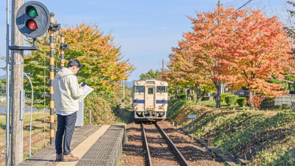
- Download offline maps before you leave a city. In Google Maps you can save a custom area for offline use. Driving directions work offline as long as your whole route sits inside the downloaded area.
- Know what offline maps cover. Google’s help page states that offline maps handle driving directions, while transit, cycling and walking directions, traffic data and alternate routes need a connection. For hiking and cycling, that is worth planning around — carry a paper map or a dedicated route file.
- Check the download works for your area. Google notes that offline map availability varies by country and region for contractual and technical reasons, so it is good to confirm the area saves before you fly rather than at the trailhead.
- Refresh offline maps before departure. They expire; Google Maps tries to update automatically when a map is within 15 days of expiry and Wi-Fi is available, which is a reason to open the app on hotel Wi-Fi the night before a rural leg.
- Save the things you will need without data: accommodation address in Japanese, ferry and bus timetables, your booking confirmations, and offline translation packs.
- Check your eSIM’s carrier list against your route on the carrier maps above, before you buy rather than after you arrive.
- Consider a second line. If your itinerary is heavily rural, having two eSIMs on different Japanese carriers gives you a handy fallback — a common approach for trips that spend most of their days away from the cities.
Frequently asked questions
How do Docomo and au compare in the mountains?
Both are solid choices, and no official source ranks them. What is documented is that Docomo publishes a dedicated mountain-coverage program and a per-mountain trail lookup, which gives you more information to check before you go. Compare the two carriers’ maps for your specific area rather than relying on a general rule.
Will my eSIM work on the Shinkansen and on local trains?
Coverage along major corridors is generally built out, but long tunnels interrupt any carrier’s signal. Docomo treats tunnel and subway coverage as a separate category on its area site, which tells you these sections are engineered individually. Download anything you need before a long tunnel section rather than assuming continuous data.
Would pocket Wi-Fi suit a rural trip?
A rented pocket Wi-Fi router runs on one of the same Japanese carriers, so it follows the same coverage map as an eSIM on that carrier. Its strength is sharing one connection across a group, which makes it a good fit for families and teams travelling together; solo travellers who like to keep their bag light often find an eSIM the easier fit. Choose by group size and how you prefer to pack.
Can I switch networks manually if I have no signal?
Some roaming eSIMs let your phone select among more than one Japanese carrier, which is one reason a multi-operator plan is worth preferring for rural travel. Whether manual selection is available depends on your provider and handset, so check your provider’s own help pages before your trip.
How current are these prices and coverage figures?
The prices above were taken from the providers’ own plan pages in August 2026, and eSIM pricing changes often. The MIC 5G figures are as at the end of FY2024 (31 March 2025), and KDDI’s coverage figures come from its April 2025 announcement. Always re-check on the official pages linked below before buying.
Show sources
- Publication of 5G Development Status (As at the End of FY 2024) — Ministry of Internal Affairs and Communications (accessed 2026-08-31)
- au Expands Coverage to Cover All of Japan with au Starlink Direct — KDDI News Room (accessed 2026-08-31)
- “au Starlink Direct” Now Available to Other Carrier Users — KDDI News Room (accessed 2026-08-31)
- 通信・エリア (Network and service area) — NTT Docomo (accessed 2026-08-31)
- 山間部・登山道のエリア対策 (Coverage measures for mountain areas) — NTT Docomo (accessed 2026-08-31)
- 携帯電話をご利用になれる登山道 (Climbing routes with mobile coverage) — NTT Docomo (accessed 2026-08-31)
- エリア:スマートフォン・携帯電話 (Service area) — au / KDDI (accessed 2026-08-31)
- サービスエリアマップ (Service area map) — SoftBank (accessed 2026-08-31)
- 通信・エリア (Network and coverage) — Rakuten Mobile (accessed 2026-08-31)
- eSIM Japan 10GB data — 30 days — Ubigi (accessed 2026-08-31)
- eSIM Japan Unlimited data — 15 days — Ubigi (accessed 2026-08-31)
- Japan eSIM — Moshi Moshi, 10 days unlimited — Airalo (accessed 2026-08-31)
- Download areas and navigate offline — Google Maps Help (accessed 2026-08-31)

Keep reading

Physical SIM Cards in Japan: Where to Buy One in Person, What It Costs, and How Setup Works
If your phone takes a plastic SIM card but not an eSIM, you can still walk into a store in Japan and…

Pocket WiFi Rental in Japan Compared: Japan Wireless, NINJA WiFi, Sakura Mobile, Global WiFi and WiFiBOX
Five Japan pocket WiFi rental services compared on their own published prices: per-day rates, 7- and 30-day totals, data rules, pickup and…
iPhone Low Data Mode in Japan: Save Your eSIM Data for the Day
A practical iPhone checklist for a limited Japan data plan: Low Data Mode, app permissions, usage checks and a hotel backup routine,…
1 comment